

Grand Canyon R2R2R Trail Run
We drove to Arizona and met Nate and Mack at the Grand Canyon to run Rim to Rim to Rim (R2R2R). This is a 48 mile trail run with 11,000 feet of elevation gain that starts at the south rim, goes down to the River and up to the North Rim 24 miles away. We then turn around and run back. On the way to the Grand Canyon we stopped in Page Arizona (they have a Tesla Supercharger there) and explored that area. On the way home we spent a couple days in Zion.

Near Page, Arizona is Horseshoe Bend, a curved portion of the Colorado just below Lake Powell. This is the desert landscape leading to the lookout.

A view of Horseshoe Bend in the morning as the sun rises and illuminates more the rock formations and then the river.

Taking a photo of Horseshoe Bend.

This is a photo of Horseshoe bend at sunset the same day.

Lots of interesting rock formations all around Page.

About 30 miles north of Page is an area called the Toadstools located in Grand Staircase Escalante, Utah..

Hiking through the Toadstools.

I don’t know if the park was named after this toadstool, but it certainly looks like a toad.

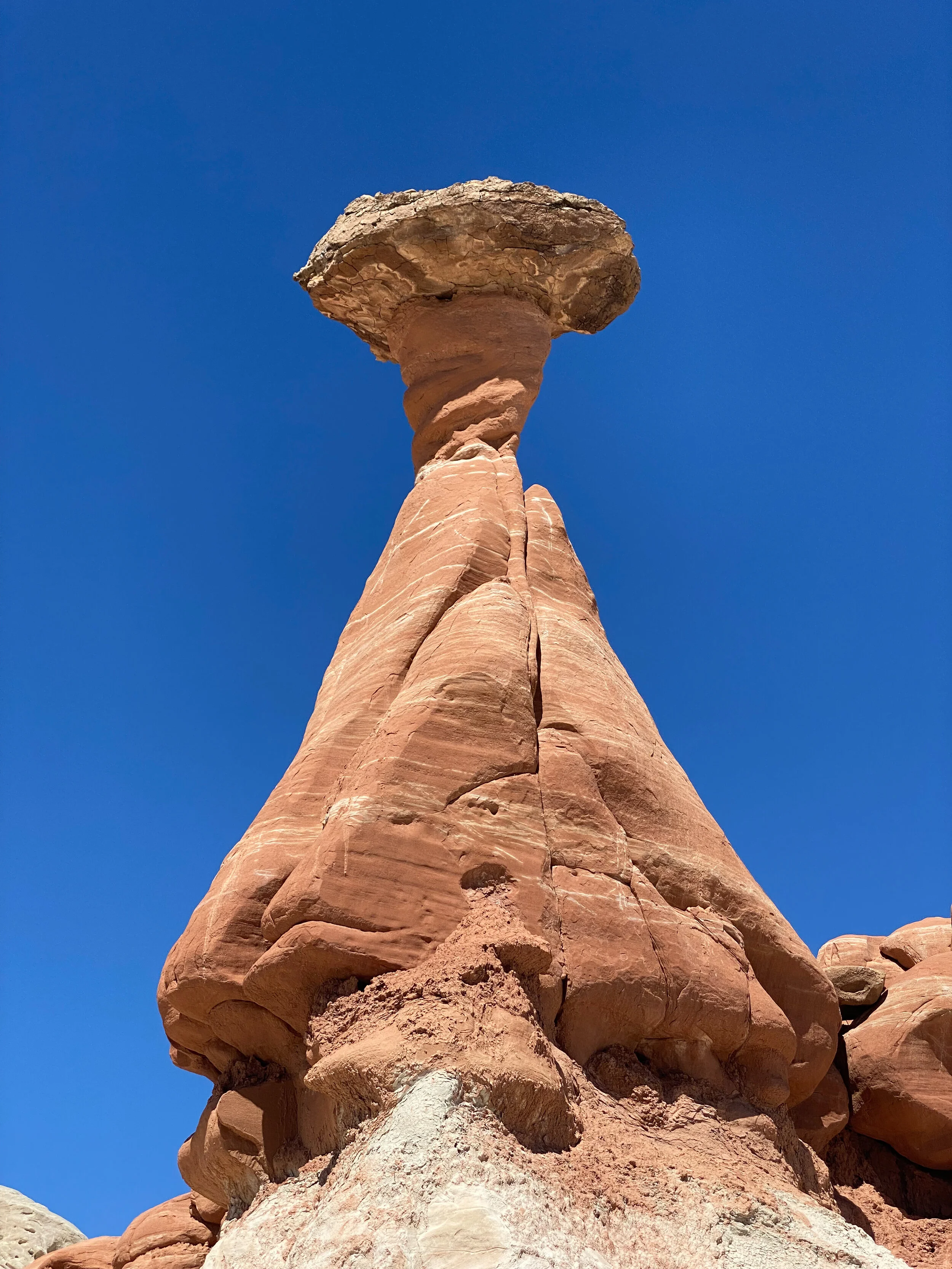
A toadstool (also called hoodoo) is formed when softer Entrada Sandstone erodes from the area around a harder sandstone rock. As the Entrada erodes away, the harder rock forms a cap that leaves the column sheltered from water and wind.


From Page we drove into Grand Canyon National park from the East. This view looks toward the North rim from the South rim. . Rim to Rim to Rim follows the canyon just right of the center of the photo up to the North Rim and then back.

El Tovar hotel right on the South Rim. Amazing hotel that first opened in 1905. It books long in advance and we could not get a room. We did snag a nice view room at the Thunderbird Lodge net door.

Looking out from the south rim at sunset.

Lots of empty Tesla Superchargers in Tusayan near the Grand Canyon.

A map of our route. The south rim starting point is at the bottom, the Colorado river crosses in the center and the North rim is at the top.

A picture of Nate illuminated by headlamps.

Sunrise looking North.

Looking back at the South rim where we started.

Bright Angel trail past Indian Garden.

Approaching the Colorado River.


Lots of Cacti blooming.

The North Kaibab trail heading toward the North Rim.


Staci running across the North Kaibab trail bridge.

Looking back toward the South Rim.

The morning after Rim to Rim to Rim - happy we are done.

After the Grand Canyon we went to Zion to attempt Angels Landing again.

Angel’s landing is a 4.4 mile roundtrip that ascends 1600 feet to the top of a beautiful mountain. The first thousand feet are easy hiking and the last 600 feet are scrambling up the section in this photo.

Angels Landing is one of the few National Park trails that still has chains on the steep sections.

The top of Angels Landing.

Rich on top of Angels Landing.

Zion at sunset - taken from Springdale.


