

Highpoints Driving to North Carolina
We decided to drive to North Carolina to visit Rich’s family for Thanksgiving. To break up the drive and explore some new and interesting places, we chose a route that would allow us to hit most of the state Highpoints between Boulder and Raleigh. Some of the highpoint were nothing more than a hill in the middle of a cornfield (Kansas) while others were significant mountains (North Carolina).

The Kansas highpoint is called Mount Sunflower (Kansas is the Sunflower state) and is located about 30 miles south of Goodland Kansas on a farm. It is on very close to the Colorado border, and to the lowest point in Colorado. It is located on a very large farm owned by Ed and Cindy Harold. They love people to visit their highpoint and Ed drove 2 miles from his house to say hello to us. Ed asks everyone to bring a book for his small library, leave a beer and sign the summit log.

A panorama of the highpoint with the little library on the left.

Rich sitting next to the library. It was a cold blustery day in Kansas.

Driving east toward Wichita, where we stayed that night, you pass hundreds of wind turbines.

After Kansas, we drove to Arkansas where we did a short hike to the top of Mount Magazine, the Arkansas Highpoint.

Mount Magazine is in a beautiful park with a nice campground and very expensive lodge you can stay at. This is a beautiful area of Arkansas near the Ozark National Forrest and the lakes.

We drove from Arkansas to Memphis to spend a couple nights. We both wanted to see more of Memphis. It was a little surprising how deserted downtown Memphis was, even on a Friday night.

Memphis has a climbing gym called Memphis Rox that was featured in a short ReelRock film called Black Ice. We were amazed at how large and cool this gym was and would love to go back and climb there.

From Memphis, we drove to Mississippi, a state that Staci hadn’t yet visited. We drove to the top of Woodall Mountain, the Mississippi highpoint, where we hiked around a little. This was one of the least interesting highpoints so far. There were no trails and only a small plaque and bench to mark the highpoint.

We drove from Mississippi to Blairstown, Georgia where we spent the night. Blairstown is a bit of a resort town as it is close to a lot of outdoor activities (mostly hunting and fishing, but also kayaking and hiking).

Brasstown Bald is the Georgia highpoint and is located in a beautiful park. This highpoint had a large number of trails and we really enjoyed the hiking to the top, even though it was foggy and wet.
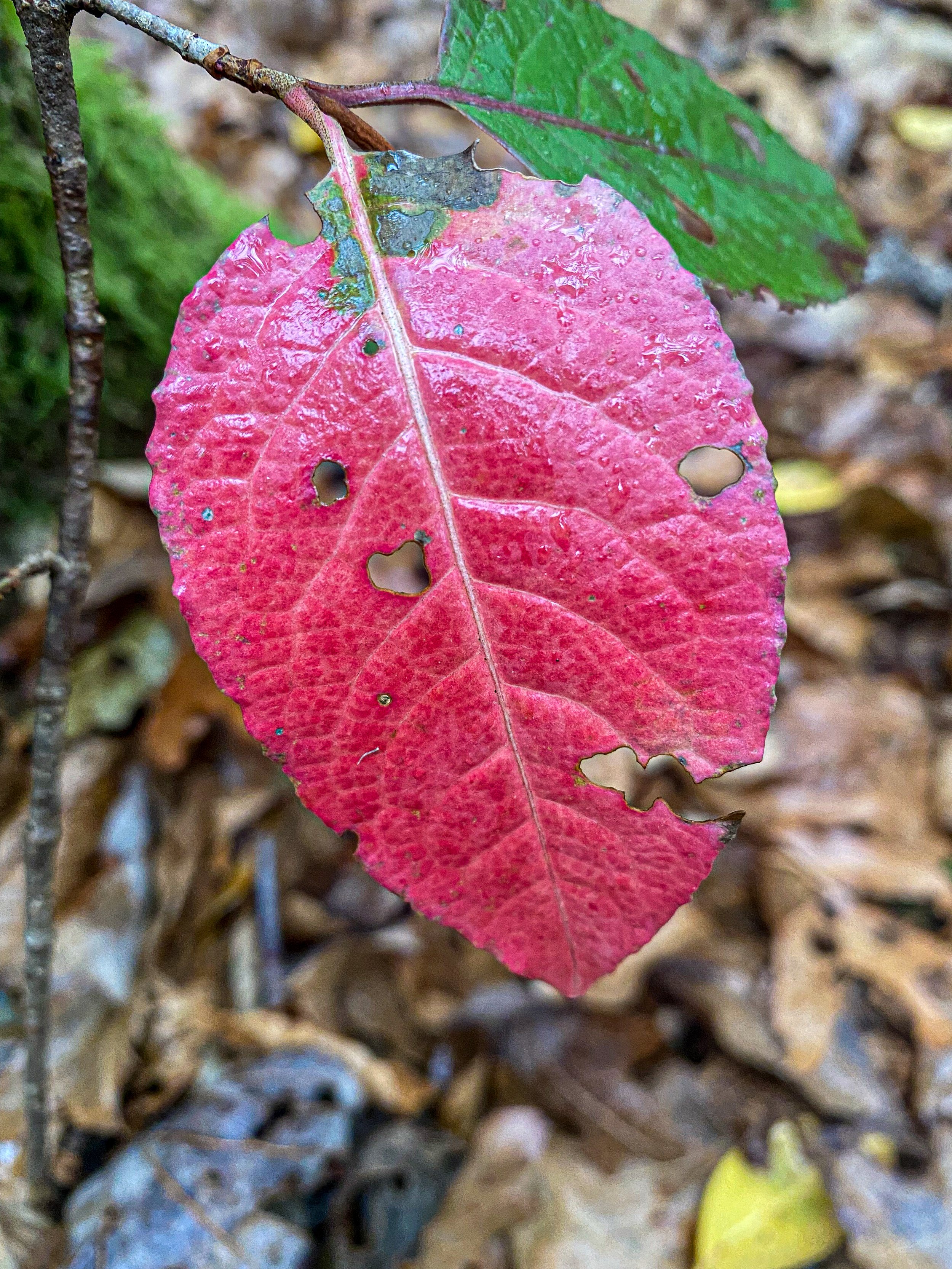
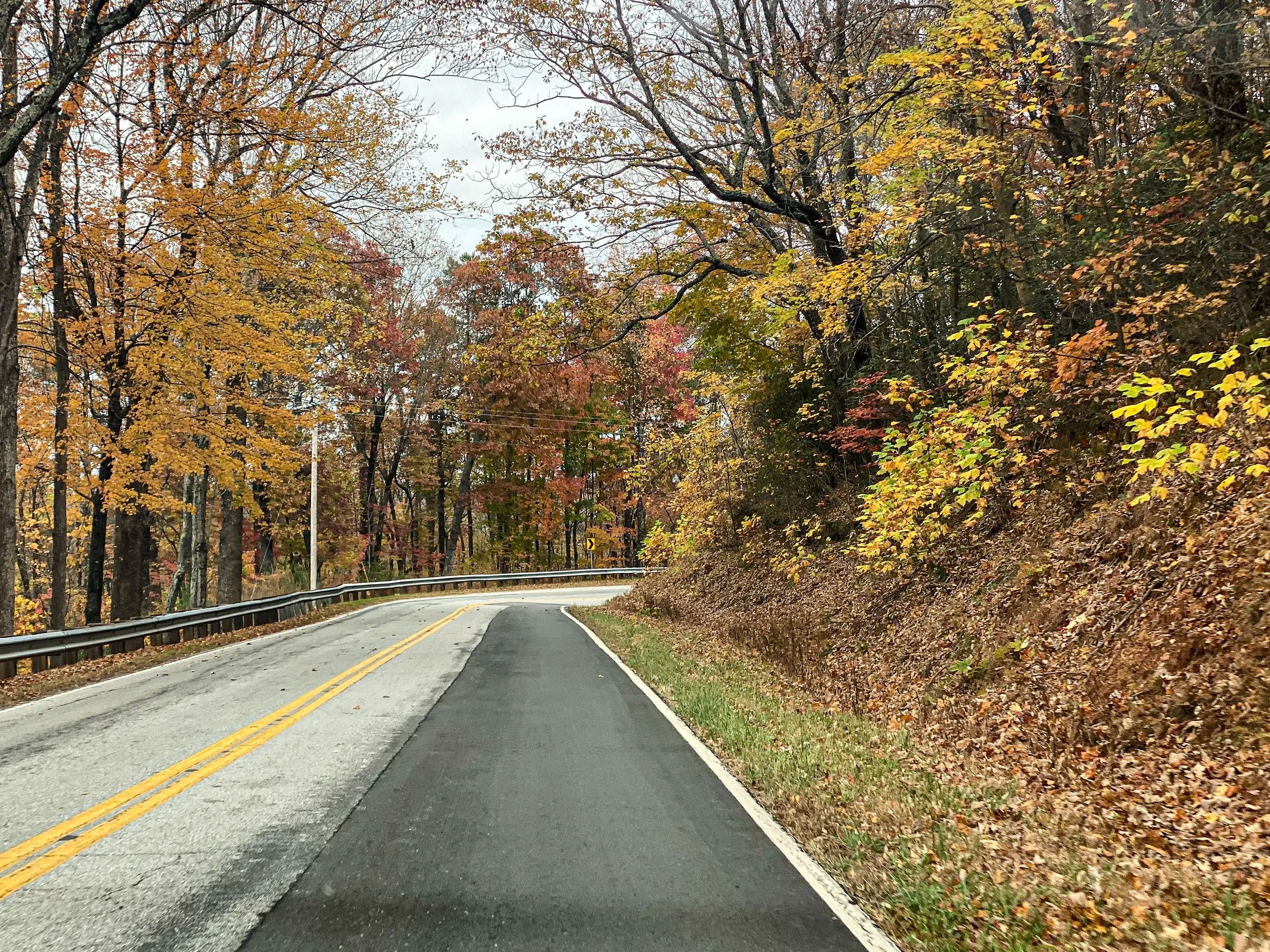
The hike to the top was mostly through a dense forrest. We missed the peak of color but a few colorful fallen leaves reminded us how spectacular fall must be in this area.

The top of Brasstown Bald has an impressive summit observation building.
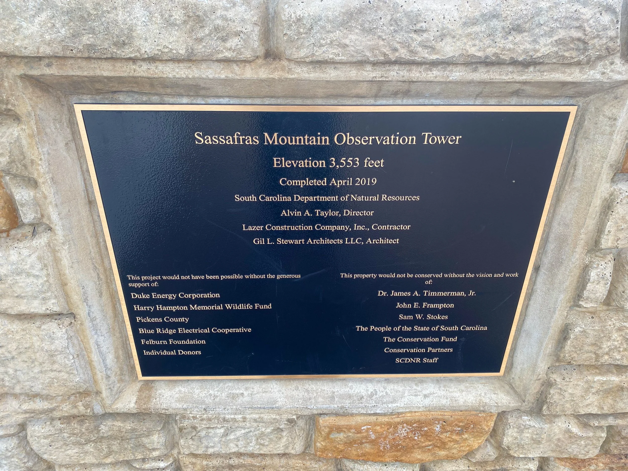
From Georgia, we drove to South Carolina were we visited Sassafras Mountain, the South Carolina highpoint.

The interesting thing about the Sassafras Mountain is that it is on the border of South Carolina and North Carolina.

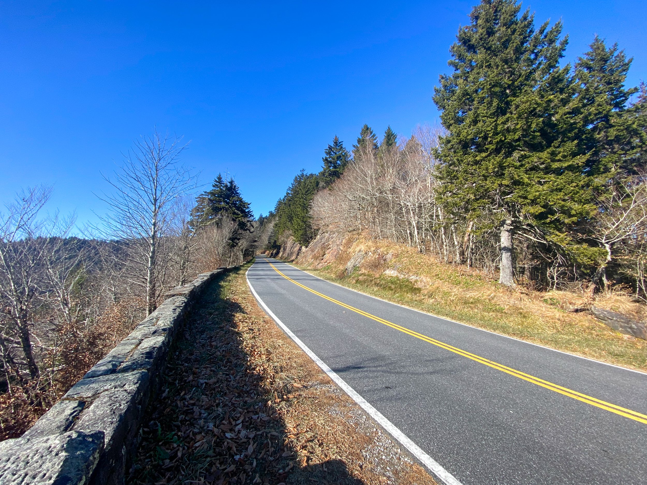
We spent the night in Asheville, North Carolina and planned to hike to the top of Mount Mitchell the next day. Unfortunately the weather didn’t cooperate as it was wet, foggy and cold when we woke up. Instead of hiking we drove the Blue Ridge Parkway to the Mount Mitchell Visitor’s Center, where we hiked the summit trail a half mile to the summit.

The Blue Ridge Parkway is spectacular, even when it is foggy.

Mount Mitchell is the highest point east of the Mississippi. It is an impressive Mountain with a huge trail network.

It was cold, windy and wet on top of Mount Mitchell.

Hiking the trails near the top.

As we got closer to Asheville the sun finally appeared.

We spent a week Cary, North Carolina at Rich’s parents. While there we ran the Cary Turkey Chase 10K with our friends Jon and Miranda. It was a casual race (at least compared to the other ones we did this year) and Staci finished 2nd among the women and Rich finished 4th among the men. The race took place on dirt roads in Umstead State Park, which is a beautiful wooded area outside of Raleigh and Cary.

After leaving Cary, we drove west past Ashville to the Smoky Mountains. We stayed in Knoxville, Tennessee which appeared to be the car dealership capital of the country. The number and size of the car dealerships was unlike anything we’ve ever seen.

The last highpoint of the trip was Clingmans Dome. At 6,643 feet Clingmans Dome is the third highest peak east of the Mississippi, the highest point on the Appalachian Trail and the highpoint of Tennessee. It is located in Great Smoky Mountain National Park which is the most visited National Park in the country.

It is 16 miles roundtrip to the top of Clingmans Dome. You can either take the Appalachian Trail or walk the road to the top. Since the road was closed for winter, and has better views than the trail, we chose to hike up the road.
The road to the top of Clingmans Dome.

Frozen waterfalls appear along the shady sections of the road.
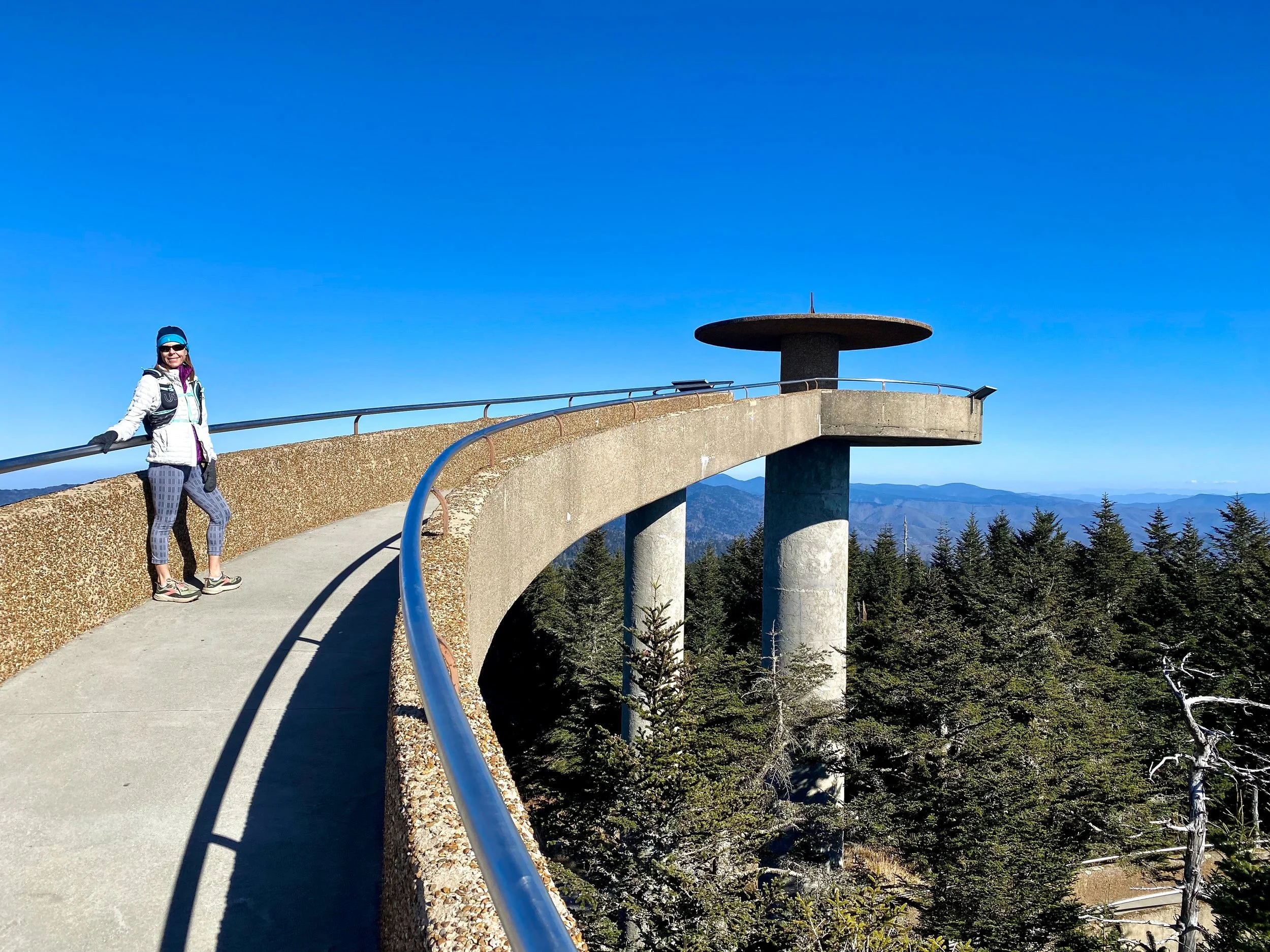
The summit observation deck on Clingmans Dome looks like a spaceship.

The Smoky Mountains are named for the foggy haze that is visible most of the year. The famous blue fog is produced by native vegetation releasing organic compounds.

After leaving Knoxville, we headed for Frozen Head State Park. Frozen Head is the home of the most unique ultramarathon in the world - The Barkley Marathons. The Barkley is mostly off trail and requires a lot of challenging orienteering. The race has been taking place since 1986 and only 15 runners have ever finished it . Since 017 there haven’t been any finishers. To learn more about the Barkley, watch “The Race that Eats its Young” on Amazon Prime Video.

The famous yellow gate is the starting point for the Barkley Marathons.

We had beautiful weather in Frozen Head. Frequently the mountains in the park create a their own weather and it is often a major factor during the race. The race was created by Gary “Laz Lake” Cantrell. His idea for the race was inspired by the 1977 escape of James Earl Ray, the assassin of Martin Luther King, Jr., from the Brushy Mountain Prison located next to the park. After escaping, James Earl Ray was only able to walk 8 miles in 55 hours through the Frozen Head forrest before being found. Laz was talking to friends joking that a person should be able to cover at least 100 miles during that time. That discussion led to the creation of the race, which was named for Laz’s running buddy, Barry Barkley.
While in the park we hiked the Bird Mountain loop, which was on nice trails. Most of the park is very steep and remote without trails.

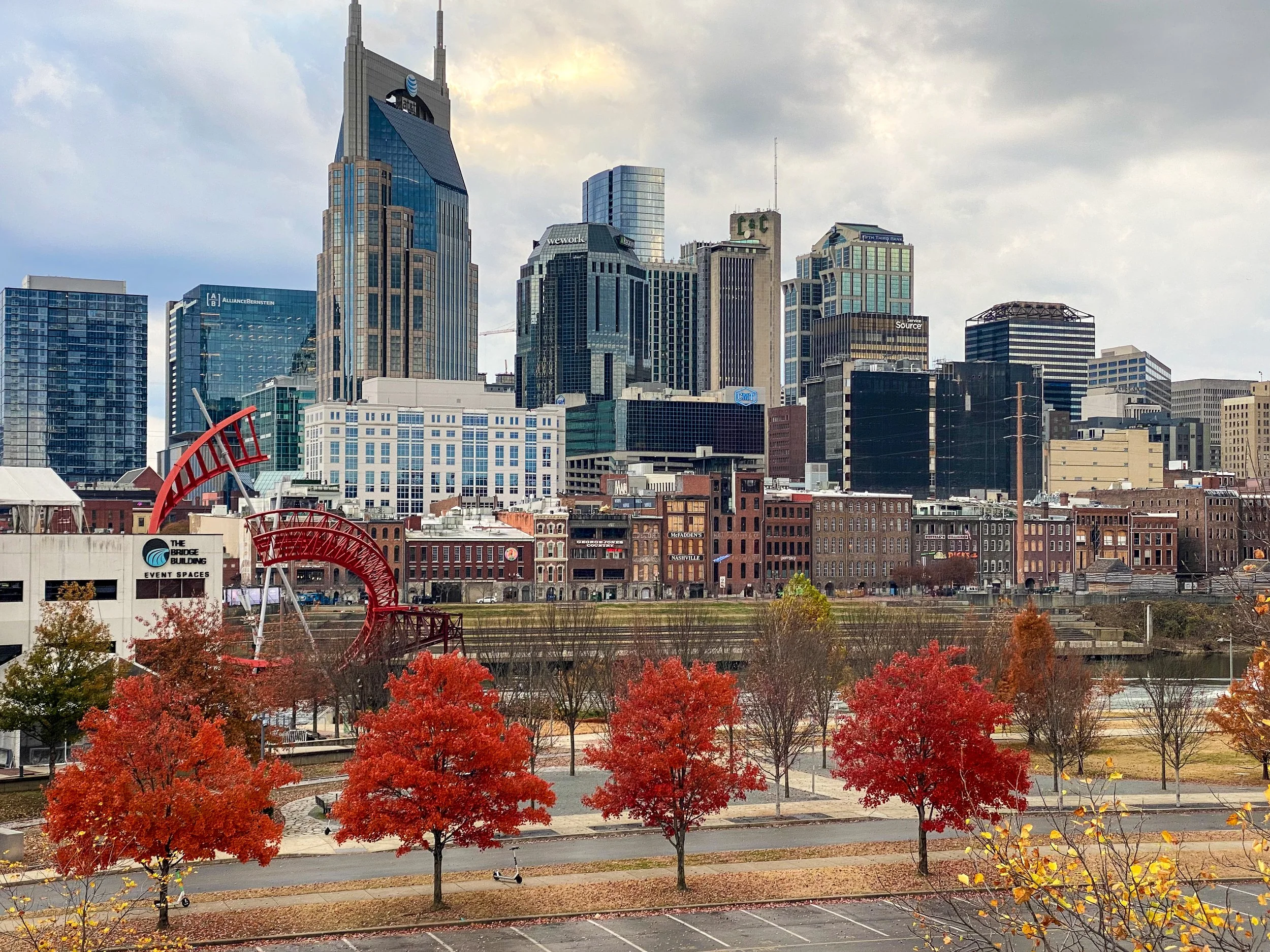
On the way home we stopped in Nashville, Tennessee.

Nascar is a pretty big deal in the Southeast.
After Nashville we drove to Columbia, Missouri where we spent our last night and then continued home to Boulder. Happy to be back in Boulder after a 4,300 mile trip in the Tesla.


